Skapat en lekplats åt havsöring och flodnejonöga
Kustens fiskar har fått det mer och mer tufft. Den miljö de behöver för att trivas och leka har försämrats och ibland till och med försvunnit.
Därför är det viktigt att identifiera platser som kan göra skillnad och erbjuda positiva miljöer för fiskarna. Hargsån är en sådan. Ån identifierades som en plats som skulle kunna restaureras och bli en lämplig barnkammare åt kustens fiskar.
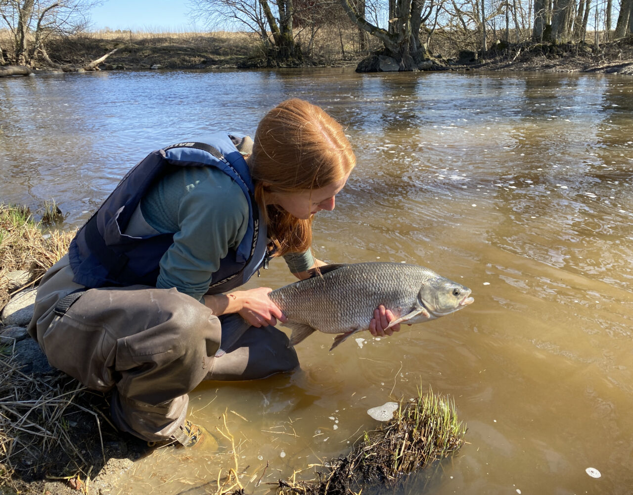
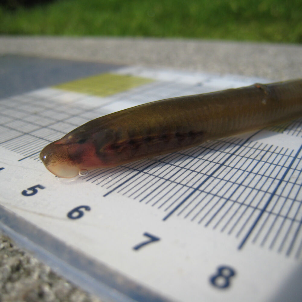
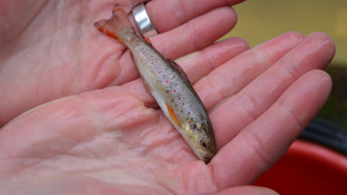
Efter flera års arbete är responsen enorm hos de olika fiskarterna som nyttjar Hargsån. Havsöringen har kommit tillbaka, det hotade flodnejonögat syns titt som tätt och id vandrar upp i hundratals. Gädda och abborre når fram till nya lekområden i ån.
Tog bort dämmen, lade dit sten och ved
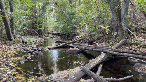
Ån har restaurerats i etapper. Flera vandringshinder har tagits bort i Hargsåns nedre delar. Den fallhöjd som frigjordes när dämmen togs bort kunde användas till att återskapa ett mer naturligt vattendrag, med porlande vatten.
På en sträcka av tvåhundra meter lade vi ner 18 dumperlass med grus, sten och block. På så sätt återskapade vi något som kan liknas vid ett orört vattendrag. Vi lade även dit stora mängder död ved i och kring ån vilket förutom att gynna fiskarna även gynnar insektslivet och strömstaren. Sammantaget skapade detta nya strömbiotoper med lekplatser, ståndplatser och varierande livsmiljö som många arter trivs i.
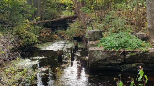
Öppnat fritt flöde genom meanderbågarna
Vi har också öppnat upp avsnörda meanderbågar i delar av Hargsån. Meanderbågar är de kurvor i åar och bäckar som bildas naturligt när ett vattendrag får rinna fritt och skapa sin egen väg fram i landskapet. Genom bågarna får vattnet olika hastighet vilket skapar förutsättningar för fler arter att trivas. Dikning av vattendraget har gjort att dessa områden grävts bort. Men i Hargsån har de funnit kvar, om än torrlagda.
Nu rinner vattnet åter igenom dessa och bidrar till ett rikare växt- och djurliv med lekande gädda och abborre.